
Last Driven September 2011
AMP: 274
Location: I-4o and Main St, Navajo Cty
Reassurance shield as we head out of Joseph City

AMP: 269
Location: I-40 and Jackrabbit Trail, Navajo Cty
Reassurance shield a few miles later after the Jackrabbit Trail interchange
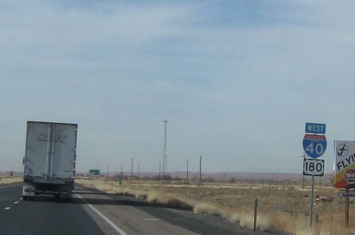
AMP: 264
Location: I-40 and Hibbard Rd, Navajo Cty
Reassurance shield after Hibbard Rd as we pass through a long stretch of nothing with a lot of traffic
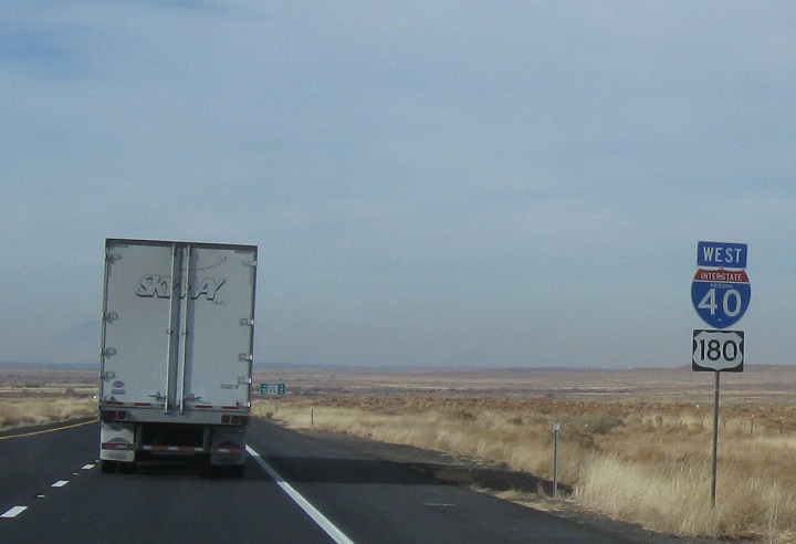
AMP: 264
Location: I-40 and Hibbard Rd, Navajo Cty
6 miles to junction SR 87, 10 miles to Winslow

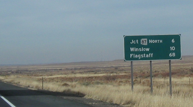
AMP: 259
Location: I-40 and SR 87, Navajo Cty
2 miles to junction SR 87.

(Historical Photo: December 2010)
AMP: 258
Location: I-40 and SR 87, Navajo Cty
1 mile to junction SR 87. This is only a good way to go for 87 north, but 87 south is accessible here too

(Historical Photo: December 2010)
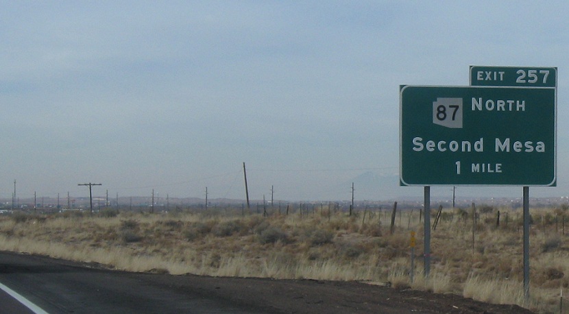
AMP: 257
Location: I-40 and SR 87, Navajo Cty
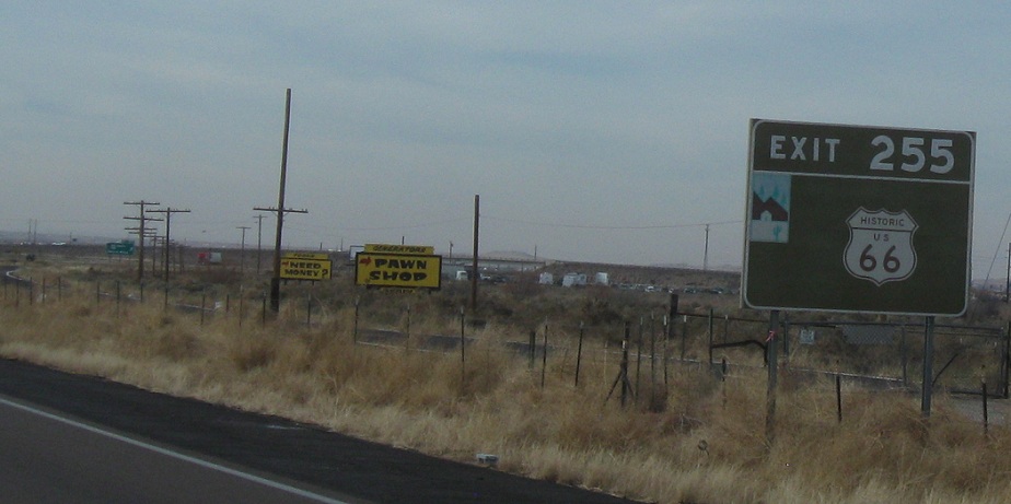
Exit at exit 255, which is the business loop exit for Old 66. SR 87 south is also a 66 alignment, so it’s weird that they used to direct folks to get off at Exit 255 instead of 257. New signage acknowledges SR 99 too, so that’s kind of cool.
AMP: 257
Location: I-40 and SR 87, Navajo Cty
Exit in half a mile for SR 87

(Historic Photo: December 2010)
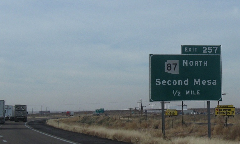
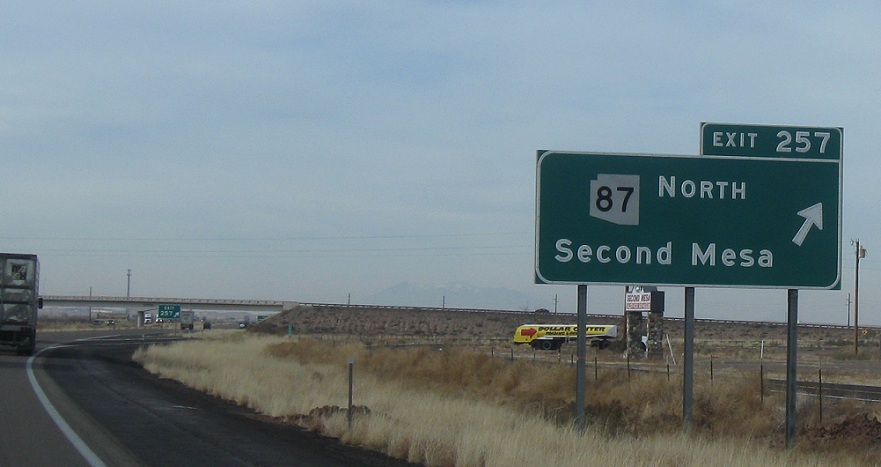
AMP: 257
Location: I-40 and SR 87, Navajo Cty
Exit for SR 87 Second Mesa and Payson. It’s unclear as to why they changed the recommended traffic flow with the resigning, but the new is closer to fact, if not a slightly less efficient way to get to 87 south.


