AMP: 14
Location: Pilgrims Hwy and Samoset St, Plymouth
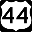
Reassurance shield after the U.S. 44 split.

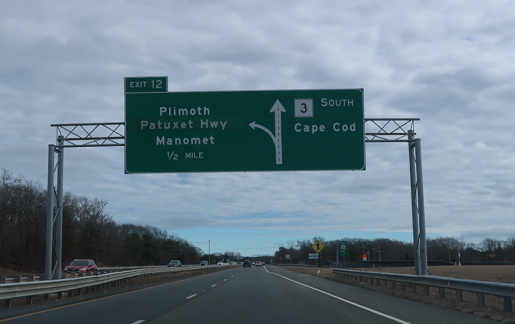
AMP: 13
Location: Pilgrims Hwy and South St, Plymouth
In a mile, the unnumbered Plimoth-Patuxet Highway exits to connect to historic Plimoth.
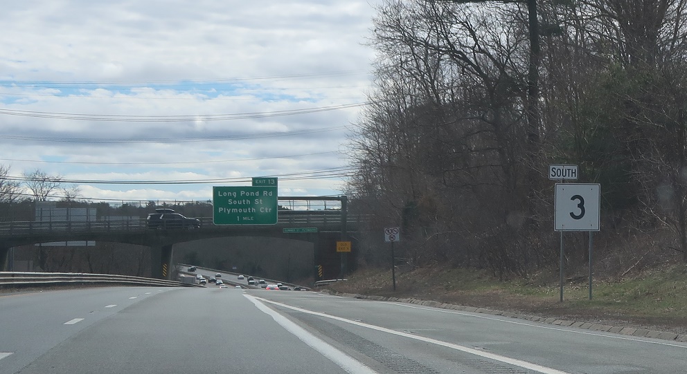
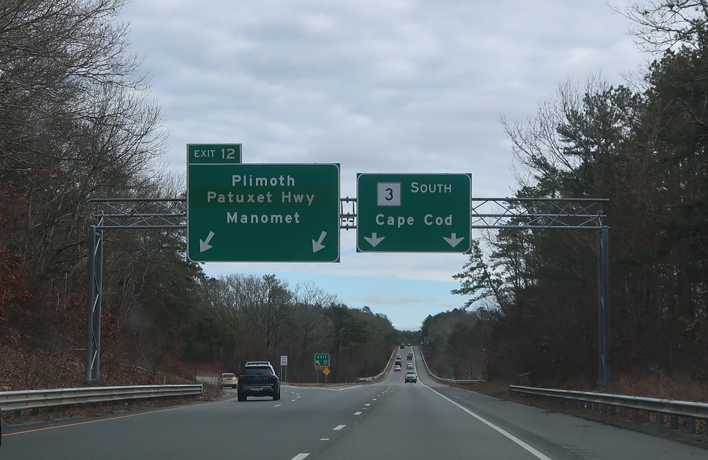
AMP: 13
Location: Pilgrims Hwy and South St, Plymouth
1/2 mile to the Plimoth-Patuxet Highway.
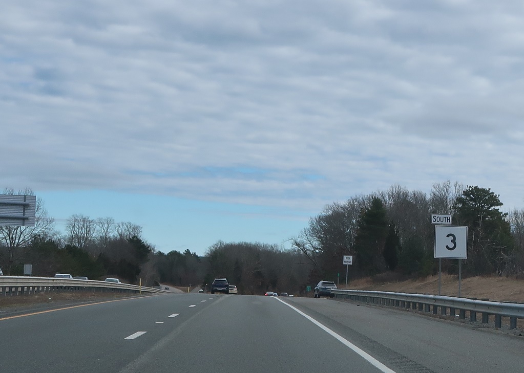
AMP: 12
Location: Pilgrims Hwy and South St, Plymouth
Reassurance shield after the South Street interchange.
AMP: 12
Location: Pilgrims Hwy and Plimoth-Patuxet Hwy, Plymouth
Keep left for the Plimoth-Patuxet Highway.
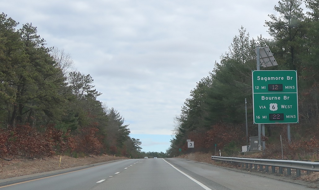
AMP: 11
Location: Pilgrims Hwy and Plimoth-Patuxet Hwy, Plymouth
We’re twelve miles from the Sagamore Bridge and sixteen miles from the Bourne Bridge via U.S. 6.
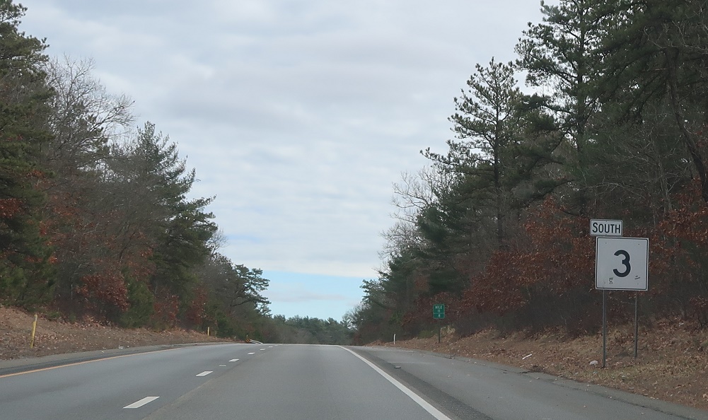
AMP: 11
Location: Pilgrims Hwy and Plimoth-Patuxet Hwy, Plymouth
Reassurance shield after the Plimoth-Patuxet exit.

AMP: 9
Location: Pilgrims Hwy and Clark Rd, Plymouth
Reassurance shield a couple miles later not associated with an interchange.

AMP: 7
Location: Pilgrims Hwy and Clark Rd, Plymouth
Reassurance shield after the Clark Rd interchange.
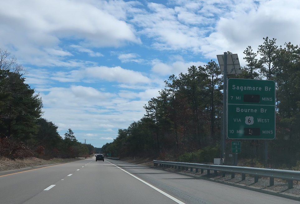
AMP: 6
Location: Pilgrims Hwy and Clark Rd, Plymouth
Seven miles to the Sagamore Bridge; ten miles to the Bourne Bridge.
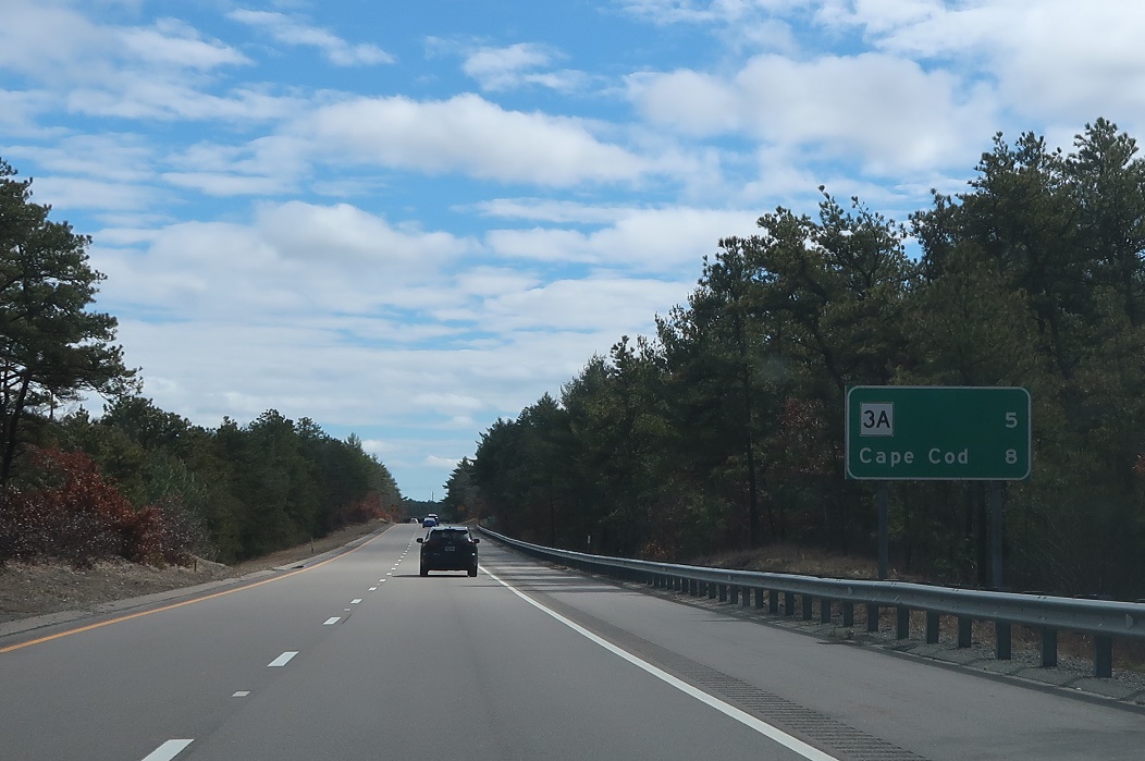
AMP: 6
Location: Pilgrims Hwy and Clark Rd, Plymouth
Five miles to the southern terminus of Route 3A.
AMP: 3
Location: Pilgrims Hwy and Herring Pond Rd, Plymouth
In a mile, we’ll approach Route 3A for the last time.
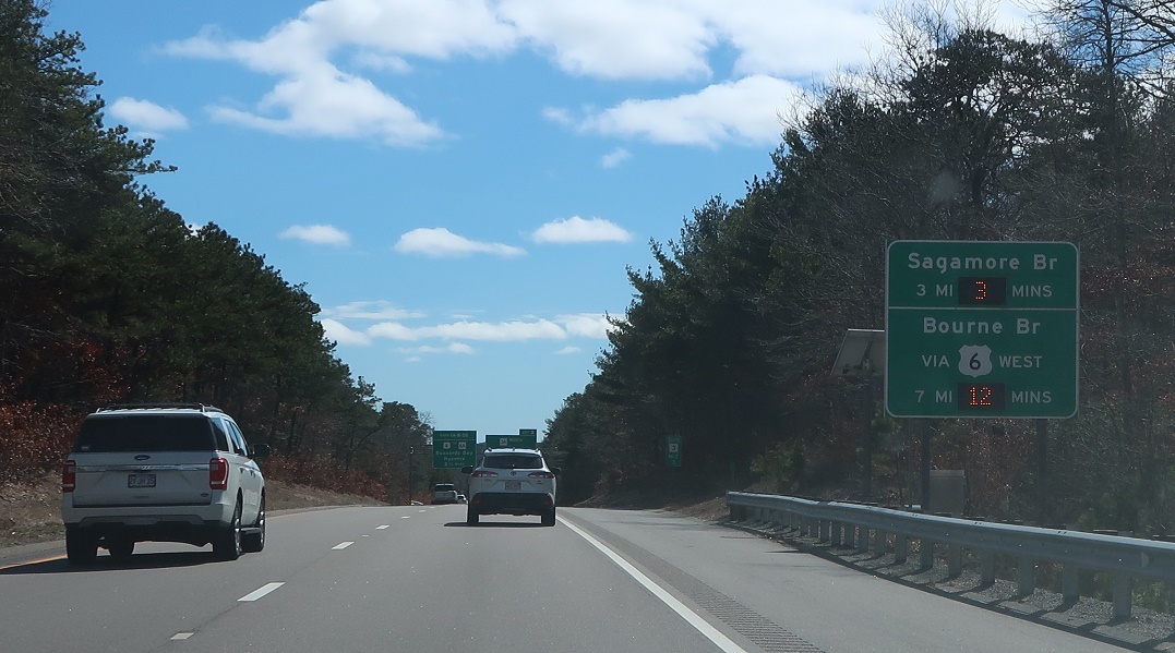
AMP: 3
Location: Pilgrims Hwy and Herring Pond Rd, Plymouth
Three miles to the Sagamore Bridge; seven miles to the Bourne Bridge.
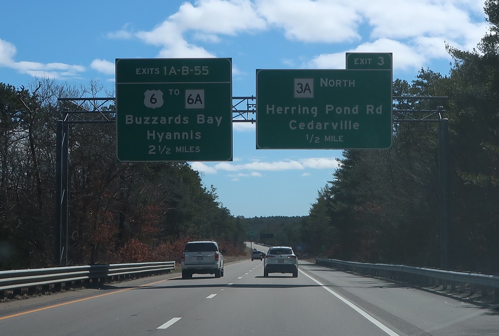
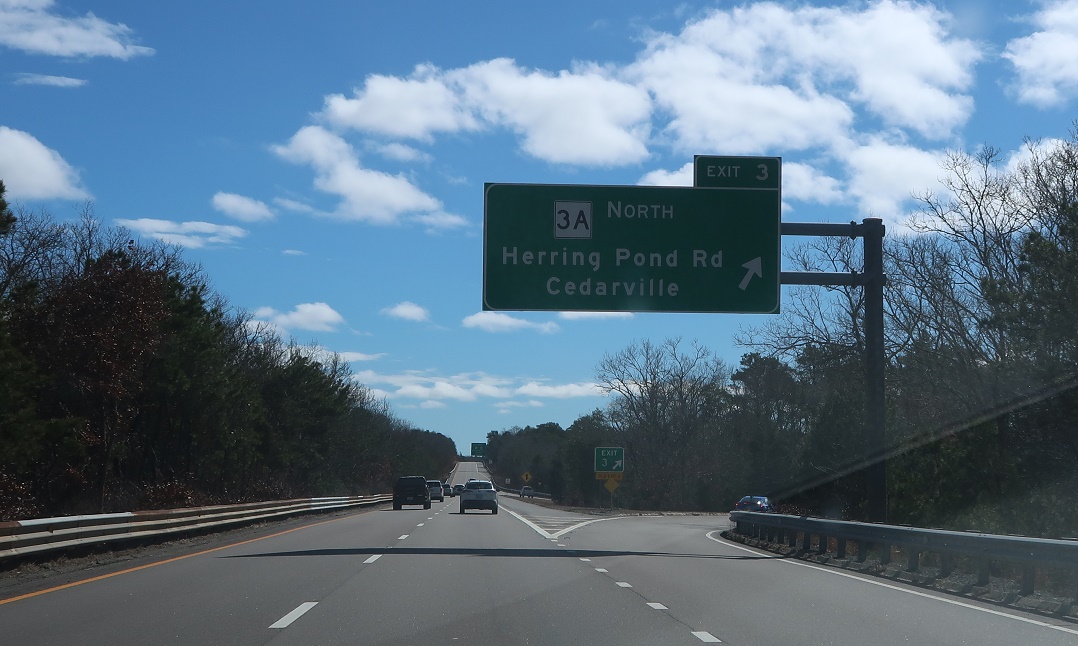
AMP: 3
Location: Pilgrims Hwy and Herring Pond Rd, Plymouth
Exit in a half mile for Route 3A north. We’re 2.5 miles from the southern terminus of Route 3 at U.S. 6.
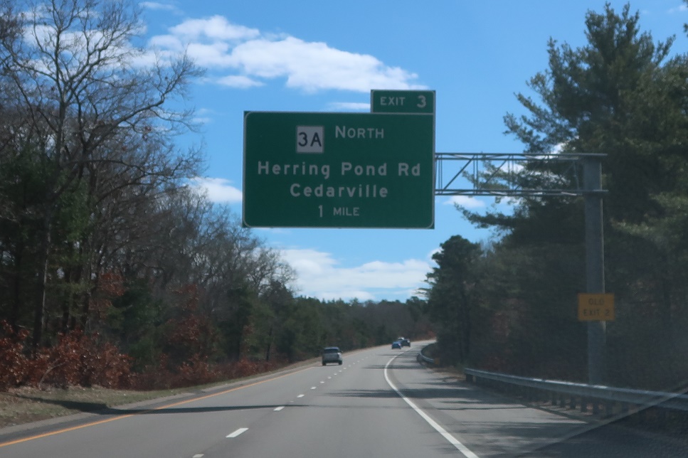
AMP: 2
Location: Pilgrims Hwy and Herring Pond Rd, Plymouth
Exit for Route 3A north.