AMP: 51
Location: I-93 and Massachusetts Tpk, Boston
Reassurance shield for I-93 as we pop out of the Big Dig and Route 1A silently joins the 93/1/1A/3/3A concurrency.

AMP: 51
Location: I-93 and Herald St, Boston
Reassurance shield with the three routes that are supposed to be signed.

AMP: 50
Location: I-93 and Southampton St, Boston
As we head out of Boston, I-93’s control city changes to Quincy.

AMP: 50
Location: I-93 and Southampton St, Boston
Reassurance shield at Southampton Street.

AMP: 50
Location: I-93 and Southampton St, Boston
Seven miles to the Route 3 freeway split.

AMP: 50
Location: I-93 and Southampton St, Boston
Reassurance shield after the Southampton Street interchange.

AMP: 49
Location: I-93 and Columbia St, Boston
Reassurance shield after Columbia Street.

AMP: 48
Location: I-93 and Morrissey Blvd, Boston
Reassurance shield after Morrissey Blvd.

AMP: 48
Location: I-93 and Freeport St, Boston
In a mile, Route 3A will split to continue south.

AMP: 48
Location: I-93 and Freeport St, Boston
As traffic from Freeport Street merges on, we’re five miles from the Route 3 freeway split and nine miles from the Route 24 freeway (via I-93).

AMP: 47
Location: I-93 and Freeport St, Boston
1/2 mile to the Route 3A split.

AMP: 47
Location: I-93 and Neponset Ave, Boston
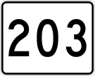
Exit in a mile to connect to Route 203, which terminates at the 3A split.

AMP: 47
Location: I-93 and Neponset Ave, Boston
Exit for 3A south, which runs parallel to Route 3 almost all the way to its southern terminus at the Cape. There is no direct access to Route 203 from this direction, but the upcoming Granite Ave exit will service it.
 S to I-93/US-1/MA 1A, N to I-93/US-1/MA 99
 N to US-1/MA 3/MA 3A/MA 99, S to MA 3
 N to I-93/MA 3/MA 3A/MA 99, S to MA 3

 N to I-93/US-1/MA 99, S to MA 53