
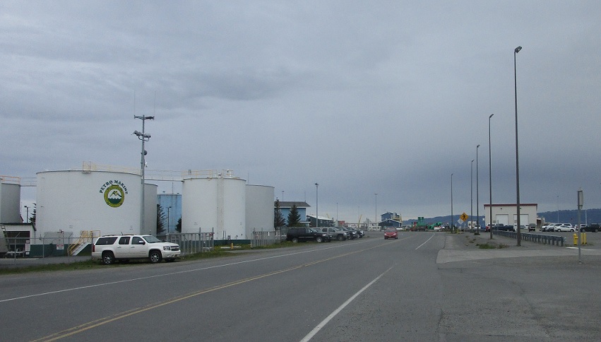
Location: Homer Spit Rd and Lands End Way, Homer
No reassurance shield as Alaska 1 begins – with the Alaska Marine Highway Ferry Terminal just to the right.

Location: Sterling Hwy and Pioneer Ave, Homer
As we head off the Homer Spit, turn right to head into regular downtown Homer.
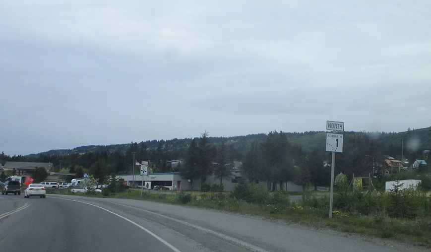
Location: Sterling Hwy and Pioneer Ave, Homer
Reassurance shield after Pioneer Ave.
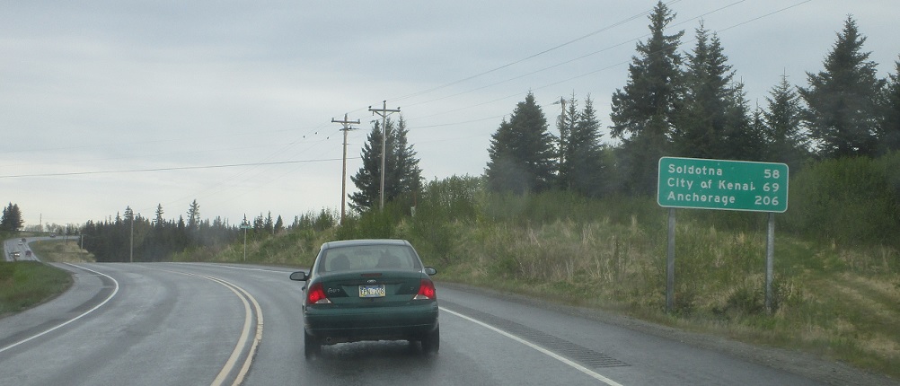
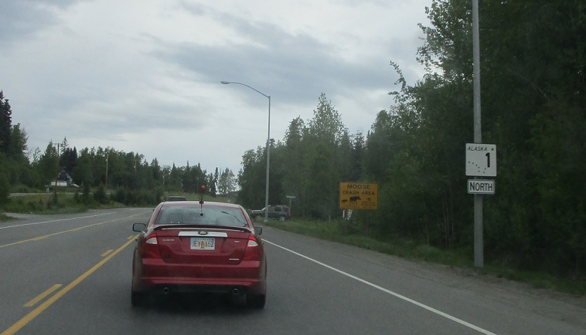
Location: Sterling Hwy and N Fork Rd, Anchor Point
As we pass by Anchor Point we’re 58 miles from Soldotna.
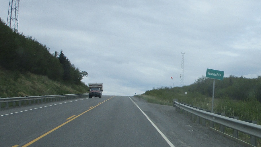
Location: Sterling Hwy and Oil Well Rd, Ninilchik, Kenai Peninsula Boro.
Welcome to Ninilchik!
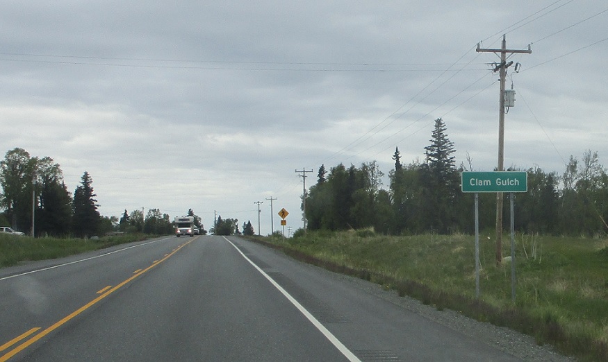
Location: Sterling Hwy and Falls Creek Ave, Clam Gulch, Kenai Peninsula Boro.
A few miles later we’ll enter unincorporated Clam Gulch.
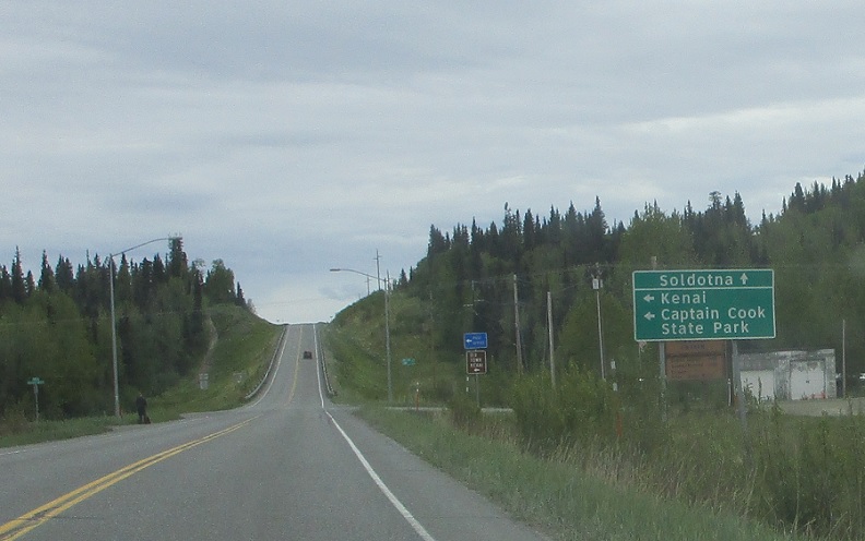
Location: Sterling Hwy and Tote Rd, Kenai Peninsula Boro.
As we near Soldotna, turn left for Captain Cook State Park.
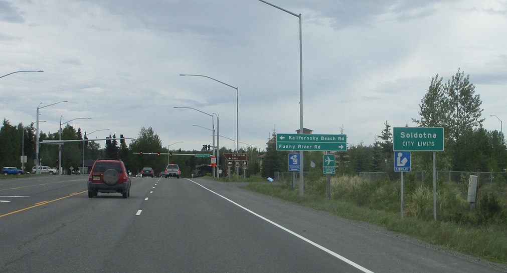
Location: Sterling Hwy and Kalifornsky Beach Rd, Soldotna
Welcome to Soldotna!
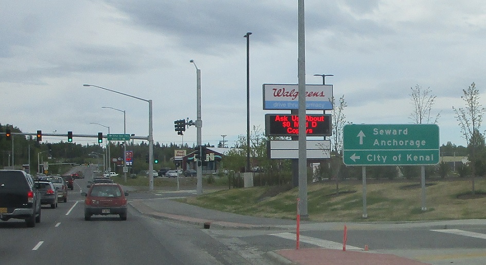
Location: Sterling Hwy and Kenai Spur Hwy, Soldotna
Follow the Kenai Spur Highway to the City of Kenai.
Location: Sterling Hwy and Heath Pl, Soldotna
Reassurance shield a few blocks later.

Location: Sterling Hwy and Grandview Dr, Sterling, Kenai Peninsula Boro.
Welcome to Sterling!
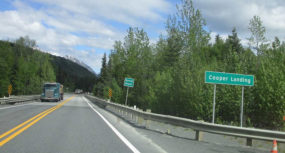
Location: Sterling Hwy and Nelson St, Cooper Landing, Kenai Peninsula Boro.
Several miles later we’ll move inland and enter Cooper Landing.
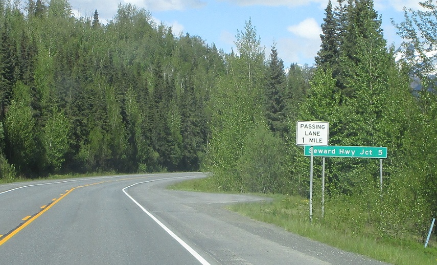
Location: Sterling Hwy and Quartz Creek Rd, Kenai Peninsula Boro.
Five miles to the Seward Highway.
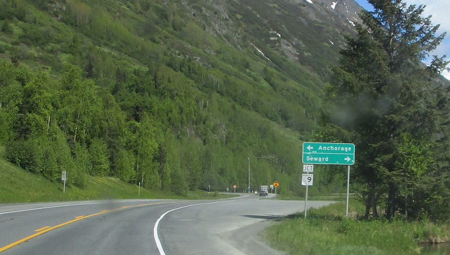
Location: Sterling Hwy and Seward Hwy, Kenai Peninsula Boro.
Five miles later we’ll approach Alaska 9, which heads down to Seward.
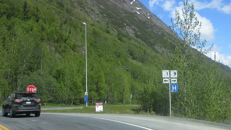
Location: Sterling Hwy and Seward Hwy, Kenai Peninsula Boro.
Turn right for 9 south. Turn left for 1 north, which takes the Seward Highway designation.


 S to Kodiak
